Business Details
We have been delivering professional surveying, mapping and remotesensing solutions across Canada for more than two decades. We specialize in cuttingedge technologies such as LiDAR, UAV photogrammetry, 3D laser scanning and satellite imagery to capture precise spatial data. We apply our expertise to sectors including construction, energy, government, land development, mining and transportation, tailoring each solution to the clients unique challenges. We operate under an ISO9001:2015 quality management system, ensuring consistent accuracy and traceable documentation for every project. We maintain a zeroincident safety record, with every employee trained to uphold rigorous healthandsafety protocols on site. We have cultivated Indigenous partnerships for over 20years, building collaborative relationships that respect cultural values and support mutual success.
We solve complex geotechnical and regulatory problems by integrating advanced GIS analysis with realtime field data. We commit to transparent communication, providing clients with detailed reports, visualisations and progress updates throughout the workflow. We employ a team of licensed professional land surveyors who uphold the highest ethical standards and professional licensure requirements. We continuously invest in stateoftheart equipment to reduce field time and deliver faster, costeffective results. We measure our success by client satisfaction, repeat business and the tangible contribution our data makes to safe, onschedule project delivery.
We solve complex geotechnical and regulatory problems by integrating advanced GIS analysis with realtime field data. We commit to transparent communication, providing clients with detailed reports, visualisations and progress updates throughout the workflow. We employ a team of licensed professional land surveyors who uphold the highest ethical standards and professional licensure requirements. We continuously invest in stateoftheart equipment to reduce field time and deliver faster, costeffective results. We measure our success by client satisfaction, repeat business and the tangible contribution our data makes to safe, onschedule project delivery.
Highlights and features
- We have over 20 years of Indigenous partnership experience.
- Our ISO 9001:2015 system guarantees consistent, accurate results.
- We employ stateoftheart LiDAR, UAV and 3D laser scanning.
- Our safety program achieves zeroincident job sites.
- We provide fullservice surveying for construction, energy and mining sectors.
Services
Construction Survey
We conduct site surveys, precision layout and asbuilt mapping for construction projects using advanced technology. Our services target developers, contractors and civil engineers who need reliable spatial data. Clients gain confidence through accurate modelling, risk mitigation and faster permitting processes.
Energy Survey
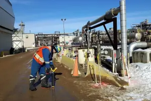
We deliver detailed topographic and pipeline surveys for oil, gas and renewable energy initiatives. Our target audience includes energy producers, project managers and regulatory bodies requiring precise geospatial data. Clients gain confidence through accurate modelling, risk mitigation and faster permitting processes.
Government Services
We provide licensed land surveyors for public land dispositions, claims and agency projects across municipal, provincial and federal levels. Our audience comprises government departments and Indigenous groups needing legally defensible survey outcomes. The service ensures compliance, reduces disputes and supports transparent decisionmaking.
Land Development
We perform legal surveys, subdivisions, strata plans and BOMA assessments for developers and property managers. Our clients range from residential builders to commercial realestate firms seeking accurate parcel delineation. Deliverables include certified plans, real property reports and documentation that expedite approvals and protect ownership rights.
Mining Survey
We support exploration, construction, production and reclamation phases with specialised surveys and 3D modelling. Our services target mining companies, engineers and consultants requiring precise volumetric and geotechnical data. Clients benefit from accelerated project schedules, reduced environmental impact and reliable data for regulatory compliance.