
Business Details
14 Years
experience
Professional Land Surveyors in Calgary
Arc Surveys, established in 2012, bridges the gap between large corporate clients and smaller clients who often face delays in receiving surveying services. We provide a full range of land surveying services tailored to residential, commercial, and construction clients in Calgary and surrounding areas. Our team of certified Alberta Land Surveyors combines extensive industry experience with cutting-edge technology, including drone surveys, to deliver accurate results efficiently. We prioritize client satisfaction through transparent pricing, personal access to our professionals, and guaranteed compliance with municipal bylaws.Backed by over a decade of experience, we ensure all surveys meet the highest standards of precision and reliability. Our commitment to innovation and customer service has earned us a reputation as a trusted partner for Real Property Reports, Development Permit Surveys, and subdivision planning. We continuously seek new technologies and methodologies to enhance our service delivery. Our dedication to community and professional excellence ensures clients receive timely, accurate, and cost-effective surveying solutions for every project.

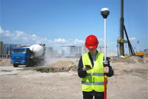
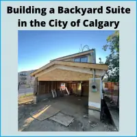
Services
Real Property Reports
Development Permit Surveys
Condominium Plans
Subdivision Planning
Infill Construction Surveys
Property Line Surveys
Construction Surveys
Drone Surveys
As Built Surveys
Underground Utility Surveys
Details
- Year established: 2012
Highlights and features
- We deliver quick turnaround times and competitive pricing on all surveying services.
- Our team includes certified Alberta Land Surveyors with over a decade of collective experience.
- We utilize drone technology to enhance accuracy and efficiency in land surveys.
- We guarantee compliance with municipal bylaws for all Real Property Reports.
- We provide personalized access to surveyors for tailored project support.
Associations and certifications
- Alberta Land Surveyors Association
What people say
Quick turnaround times
Professional staff
Accurate survey results
Transparent pricing
Highly recommended
Services
Real Property Reports
A Real Property Report (RPR) is a legal document that illustrates building positions relative to property lines and municipal bylaws. Our RPRs include detailed illustrations of physical features, compliance checks, and written surveyor opinions. We ensure accurate identification of encroachments, easements, and municipal compliance to streamline property transactions and financing.
Development Permit Surveys
Development Permit Surveys provide critical data for new projects, including property boundaries, neighboring structures, and infrastructure details. These surveys help architects and builders design compliant structures by identifying zoning regulations, easements, and site constraints. We ensure all surveys meet Calgary's planning requirements for efficient permit approvals.
Drone Surveys
Drone technology allows us to collect high-resolution topographic data faster and more affordably. Applications include volumetric analysis, 3D modeling, and orthomosaic mapping for construction, mining, and land development. This advanced method reduces costs and improves accuracy for complex sites.
Condominium Plans
We create detailed condominium plans showing unit boundaries, common areas, and amenities. These documents ensure compliance with Alberta's Condominium Property Act and municipal regulations. Our surveys support developers and buyers by clarifying ownership rights and preventing future legal disputes.
Subdivision Planning
Our subdivision services divide parcels into new legal titles while navigating municipal and Land Titles requirements. We manage the entire process from application to final registration, ensuring compliance with local regulations. We simplify complex procedures to minimize delays and costs for clients.
Questions
What is a Real Property Report?
An RPR is a legal document showing a building's position relative to property lines and municipal bylaws, including encroachments and compliance status.
How long does an RPR take?
We typically complete RPRs within a few weeks, depending on municipal review times and property complexity.
Do I need to be home for a survey?
No, but keep animals inside and gates unlocked to allow surveyor access to property boundaries.
What areas do you serve?
We provide surveys across Calgary and surrounding areas including Airdrie, Cochrane, Okotoks, and more.
Why choose drone surveys?
Drones offer faster, more accurate data collection for challenging sites, reducing costs and improving project timelines.
Can you update an existing RPR?
Yes, we assess if updates are cost-effective based on property changes and municipal bylaw revisions.
Videos