Explore 2 Trusted Surveyors Serving Vancouver, BC

Check the services, business details and available customer feedback for 2 surveyors in Vancouver, BC. Use this information to narrow your options and contact firms that may be suitable for your boundary, topographic or construction survey.
Not rated yet
Photosat Information
33 Years
Not rated yet
Photosat Information provides high-accuracy geospatial data solutions using satellite imagery and deep learning technology. Specializing in elevation surveys, alteration mapping, and mine site monitoring, we support mining, oil and gas, and infrastructure projects globally. Our engineering-grade data enables informed decision-making without requiring on-site access.
Elevation Surveys Alteration Mapping Mine Site Surveying
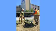
Geoscan Subsurface Surveys Canada specializes in utility locating, GIS utility mapping, and surveying services designed to reduce project risks through precise subsurface data. Our team leverages advanced technologies like ground-penetrating radar and GIS to deliver accurate as-built drawings and topographic surveys. With a focus on safety, innovation, and client-centric solutions, we serve industries nationwide, ensuring compliance with industry standards and regulatory requirements.
Utility Line Locating GIS Utility Mapping Surveying
Rigorous methodology Consistent professionalism High-quality reporting
North Vancouver (7.2 km) West Vancouver (8.5 km) Burnaby (10.4 km) Surrey (20.7 km)