Business Details
Expert Utility Locating & GIS Mapping Services
At Geoscan Subsurface Surveys Canada, we stand as Canada's leading provider of ground-penetrating radar, utility locating and mapping, surveying, and shallow geophysical survey services. As a wholly owned subsidiary of T2 Utility Engineers and part of the Kiwa Group of companies, we bring industry-leading expertise across North America. Our approach combines cutting-edge technology with a commitment to innovation, excellence, community, and honesty. We prioritize safety and customer satisfaction, ensuring projects large and small meet the highest standards.Our team of registered utility locating technicians and professional engineers is dedicated to advancing industry regulations through rigorous training and continuous development. With offices in Vancouver, Victoria, and Kelowna, we serve diverse sectors, including civil engineering, energy, geotechnical, archaeological, and environmental fields, delivering solutions tailored to client needs.
Services
Utility Line Locating
GIS Utility Mapping
Surveying
Ground Penetrating Radar
Subsurface Utility Engineering
Underground Oil Tank Locating
Archaeological Geophysics
Topographic Surveys
Slope Stability Assessments
Forensic Geophysics
Highlights and features
- Registered Utility Locating Technicians certified by ASTTBC ensure compliance and expertise.
- Cutting-edge technology including ground-penetrating radar and GIS mapping systems.
- Commitment to safety and rigorous training across all projects.
- Nationwide presence with offices in Canada and the USA for rapid response.
- Over 10 years of proven case studies demonstrating reliable results.
Associations and certifications
- Applied Science Technologists & Technicians of British Columbia (ASTTBC)
What people say
Rigorous methodology
Consistent professionalism
High-quality reporting
Deep understanding
Excellent service
Services
Subsurface Utility Engineering
Subsurface Utility Engineering (SUE) involves using ground-penetrating radar and electromagnetic equipment to locate and map underground infrastructure. Our technicians adhere to ASCE 38-22 standards, ensuring georeferenced data for construction projects. This service identifies unknown utilities, reduces risks, and saves costs by preventing delays and repairs.
Ground Penetrating Radar
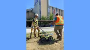
Ground Penetrating Radar (GPR) employs electromagnetic waves to detect subsurface utilities and features. Geoscan Subsurface Surveys Canada's GPR services provide real-time, non-destructive data for construction, archaeological, and forensic applications. Our trained technicians ensure precision, enhancing project safety and compliance with regulatory standards.
GIS Utility Mapping
GIS Utility Mapping captures and analyzes spatial data to create detailed utility maps. Geoscan Subsurface Surveys Canada's specialists use GIS technology to help municipalities and engineers manage infrastructure effectively. This service improves asset management, emergency planning, and cost-efficiency for large-scale developments.
Archaeological Geophysics
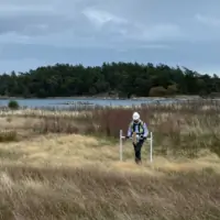
Archaeological Geophysics uses non-invasive methods like magnetometry and GPR to detect subsurface anomalies. Geoscan Subsurface Surveys Canada's services support archaeological assessments by identifying burial sites and historical structures, aiding cultural preservation and compliance with development projects.
Topographic Surveys
Topographic Surveys map land features and elevations for construction projects. Geoscan Subsurface Surveys Canada employs LiDAR and UAVs to deliver precise data, ensuring accurate planning and compliance with municipal requirements. Our surveys support efficient execution of residential, commercial, and infrastructure developments.
Questions
What services does Geoscan Subsurface Surveys Canada offer?
Geoscan Subsurface Surveys Canada provides utility locating, GIS mapping, subsurface utility engineering, ground-penetrating radar, archaeological geophysics, and topographic surveys to support construction, environmental, and archaeological projects.
Are your technicians certified?
Yes, our technicians are Registered Utility Locating Technicians (RULT) certified by ASTTBC, ensuring compliance with industry standards and regulatory requirements.
How does SUE benefit construction projects?
Subsurface Utility Engineering (SUE) reduces project risks by identifying unknown utilities, preventing delays, and saving costs through accurate georeferenced data and ASCE 38-22 compliance.
Do you operate outside British Columbia?
Yes, Geoscan Subsurface Surveys Canada has offices across Canada and the USA, serving nationwide with rapid mobilization and tailored surveying solutions for diverse projects.
What industries do you support?
We serve civil engineering, energy, geotechnical, archaeological, environmental sectors, and municipal planning with specialized locating, mapping, and surveying services.