Business Details
13 Years
experience
Licensed Metro Vancouver Land Surveying Experts
As a locally owned and operated full-service land surveying firm established in Metro Vancouver in 2013, we bring over a decade of expertise and advanced technological capabilities to every project. Our team, led by a certified British Columbia Land Surveyor with 21 years of industry experience, combines generational knowledge from a surveying family tradition with cutting-edge methodologies like 3D laser scanning and drone technology. We maintain strict quality control under the Association of BC Land Surveyors while delivering precise, affordable solutions for residential, commercial, and government clients.Our commitment to technical excellence is matched by our dedication to client education, ensuring every client fully understands their survey results. With a proven track record of accuracy in boundary determination, topographic modeling, and construction layout, we prioritize clear communication and timely delivery across our service areas. Our professionals hold advanced certifications and degrees from institutions like Moscow University of Geodesy and SAIT, maintaining rigorous standards that have earned us consistent five-star reviews for prompt, transparent service.
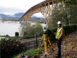
Services
Topographic Surveys
Construction Surveys
Legal Surveys
UAV Drone Surveys
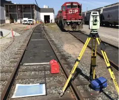
3D Laser Scanning
LiDAR Services
Volume Surveys
Property Line Surveys
Subdivision Plans
Certificate of Location Surveys
Details
- Year established: 2013
Highlights and features
- Our team includes a certified BC Land Surveyor with 21 years of industry experience and international expertise
- We utilize cutting-edge technology including 3D laser scanning and UAV photogrammetry for increased accuracy
- All surveys meet Association of BC Land Surveyors standards and municipal requirements
- We offer comprehensive service packages from initial boundary determination to final construction layout
- Proven track record of completing Metro Vancouver projects within agreed timelines
Associations and certifications
- Association of BC Land Surveyors
- BCLS (British Columbia Land Surveyor)
What people say
Highly professional
Prompt service
Thorough communication
Competitive pricing
Expertise
Services
Topographic Surveys
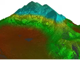
We provide detailed topographic surveys tailored to architects, engineers, and property owners. Using 3D laser scanning and drone technology, we create precise digital terrain models and building information systems. Our surveys meet municipal requirements for building permits and include optional aerial photography for challenging terrain sites.
Construction Surveys
Our certified construction surveys support residential and commercial development projects. Services include foundation layout, elevation verification, and volume calculations. We provide licensed certification of measurements and maintain detailed records for regulatory compliance throughout the construction process.
Legal Surveys
Our BCLS-certified legal surveys establish property boundaries and resolve encroachment disputes. We create official posting plans for land title registration and provide Certificate of Location surveys for mortgage purposes, ensuring compliance with provincial regulations and municipal bylaws.
UAV Drone Surveys
We utilize advanced DJI Matrice 350 RTK drones for aerial photogrammetry and LiDAR scanning. This technology enables rapid data collection for site planning, volume calculations, and environmental assessments while maintaining safety and regulatory compliance.
LiDAR Services
Our LiDAR technology captures millions of data points to create highly accurate 3D models of properties and structures. This method ensures precise measurements for complex projects while minimizing field time and reducing potential safety hazards during data collection.
People
Evgeny Petushkov
Principal Surveyor
A certified BC Land Surveyor with 21 years of experience, Evgeny holds degrees from Moscow University of Geodesy and brings generational surveying expertise. He specializes in high-precision surveys and has led landmark projects like the Highland Valley Copper Mine development.
Ian Ottmann
Senior Survey Technologist
With 15 years in geomatics, Ian specializes in 3D scanning and UAV data processing. He oversees data quality assurance and contributes technical expertise to complex projects including major Vancouver mixed-use developments.
Javier Pacheco
Survey Technologist
A certified drone pilot with engineering physics background, Javier manages field operations and develops 3D scanning applications. His expertise includes AutoCAD drafting and photogrammetry processing for construction and land development projects.
Yegor Petushkov
Survey Crew Lead
With prior GIS experience from international projects, Yegor leads field teams and specializes in traditional and digital survey techniques. He combines technical expertise with extensive outdoor experience from Alberta's provincial parks.
Questions
How can LiDAR improve my construction or land development project?
LiDAR improves project efficiency through precise terrain analysis and volume calculations. It detects obstacles and assesses land suitability before construction begins, reducing costly errors.
What if my neighbor is building on my property?
Contact the municipality with building permit details. Builders require recent surveys - request a copy first before initiating legal boundary verification through a certified surveyor.
How long is a survey valid for municipal purposes?
Most municipalities require surveys less than 6 months old. We can update existing surveys when boundary markers remain intact, avoiding complete re-surveys.
Do I need a survey if I have title insurance?
Title insurance doesn't replace surveys. Boundary clarification requires physical verification by a certified BC Land Surveyor to address specific property issues not covered by insurance policies.
What services require licensed BC Land Surveyors?
Legal boundary determinations, subdivision plans, and mortgage-related surveys must be certified by BCLS professionals who maintain regulatory compliance with provincial surveying standards.
How do drone surveys benefit property owners?
Drone technology reduces costs and timelines while improving safety. We provide aerial views, volume calculations, and detailed topographic data 30-50% faster than traditional methods.