
Business Details
Your Trusted Partner for Land Surveying Solutions
Bazett Land Surveying has been delivering precision land surveying services since the early 1980s, supporting provincial mapping programs and complex infrastructure projects across British Columbia. Our expertise spans topographic mapping, boundary re-tracement in rugged terrain, and advanced technologies like UAV LiDAR and GPS-integrated bathymetric surveys. With specialized equipment including a Cessna 185 floatplane for remote access, we provide comprehensive solutions for residential developments, small hydro projects, and First Nations housing initiatives.Our team combines decades of field experience with innovative geomatics tools to ensure accurate data collection in challenging environments. Recognized for contributions to the geomatics field, we maintain a commitment to technical excellence and client-focused service delivery.
Services
Topographic Mapping
Boundary Surveys
Hydro Project Surveys
UAV LiDAR Mapping
Bathymetric Surveys
First Nations Projects
Control Surveys
Engineering Surveys
Highlights and features
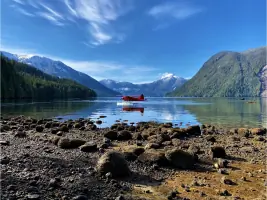
- We operate a Cessna 185 floatplane for remote location access
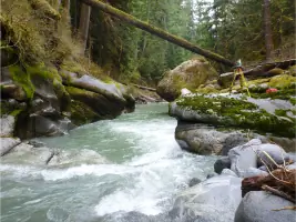
- Our team has decades of boundary re-tracement experience in rugged terrain
- We implement UAV LiDAR technology for precise geospatial data collection
- Award-winning innovation recognized at national geomatics awards
- We provide full-cycle survey solutions from planning to final mapping
Services
UAV LiDAR Surveys
Our Matrice 300 drone equipped with LiDAR technology captures high-resolution topographic data in challenging environments. This method improves survey accuracy for large-scale projects while reducing field time. Clients benefit from faster deliverables and detailed 3D terrain models for planning and construction phases.
Boundary Surveys
Specializing in retracing historical surveys across British Columbia's rugged terrain. Our team uses modern equipment to resolve property disputes and establish legal boundaries for residential and commercial developments. Clients receive certified documentation meeting provincial regulatory standards.
Hydro Project Surveys
Providing right-of-way and construction surveys for small hydro projects since the 1980s. We support BC Hydro and private developers with precise mapping for dam sites, transmission lines, and water management systems. Services include topographic base mapping and construction layout.
First Nations Projects
Delivering boundary and legal surveys for First Nations housing and infrastructure projects. Our team creates topographic site plans and legal documentation supporting community development initiatives across British Columbia's remote regions.
Bathymetric Surveys
Using integrated GPS and Knudsen sounder technology to map underwater terrain. This service supports reservoir management, riverine studies, and coastal engineering projects across BC's diverse water systems.
People
David C. Bazett
Owner
Recognized for innovation at the David Thompson National Geomatics Awards, David has led surveying projects across BC since 1980. He specializes in remote area surveys using aviation and LiDAR technologies.
Questions
What survey technologies do you use?
We combine traditional survey methods with UAV LiDAR, GPS systems, and digital sounders for precise data collection in challenging environments.
Do you work in remote locations?
Yes. Our Cessna 185 floatplane enables access to BC's most remote survey sites, and we carry all necessary field equipment for extended operations.
What survey types do you specialize in?
We focus on boundary surveys, hydro project mapping, First Nations land surveys, and LiDAR-based topographic mapping for engineering clients.
How are survey records maintained?
All surveys meet provincial standards with digital and physical records retained for legal reference and future retracement requirements.
Can you handle First Nations property surveys?
Yes. We've completed housing and infrastructure surveys for multiple BC First Nations communities with culturally sensitive land use considerations.
What makes your boundary surveys unique?
Our team has decades of experience retracing historical surveys in BC's rugged terrain using modern technology for accurate legal documentation.