
Business Details
37 Years
experience
Trusted Land Surveying Services in Northern BC
HBH Land Surveying has been a trusted leader in professional survey services across northern British Columbia for over three decades. Founded in 1989 in Smithers by Stephen Howard, we have grown into a respected firm with offices in Smithers and Prince George, serving clients from the Yukon border to Kitimat. Our team of certified professionals, including British Columbia Land Surveyors, Canada Lands Surveyors, and Geomatics Engineers, leverages decades of combined experience and advanced technologies like GPS, drones, and laser scanning to deliver precise, client-focused solutions. We prioritize ongoing staff training, safety programs recognized by the BCCSA's Certificate of Recognition, and community engagement, including partnerships with First Nations communities.Our expertise spans legal surveys, land development, high-accuracy engineering projects, and specialized services for the mining industry, ensuring clients receive tailored, reliable results. We are committed to economic sustainability in northern BC, hiring locally and maintaining transparent, collaborative relationships with stakeholders. Our dedication to quality assurance, environmental stewardship, and technical innovation positions us as a leader in challenging and remote environments.

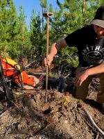
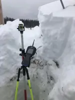
Services
Legal Survey Services
Engineering Surveys
Construction Surveys
Mining Surveys
Drone & Lidar Services
Land Development Consultation
Subdivision Surveys
Crown Grant Surveys
Strata Surveys
Mineral Tenure Lease Surveys
Details
- Year established: 1989
Highlights and features
- We have over 30 years of experience in northern British Columbias surveying industry.
- Our team includes certified British Columbia Land Surveyors and Geomatics Engineers.
- We utilize advanced technologies like drones, lidar, and high-accuracy GPS systems.
- Our safety program holds the BCCSA's Certificate of Recognition (COR).
- We prioritize local hiring and collaborative relationships with First Nations communities.
Associations and certifications
- BCCSA's Certificate of Recognition (COR)
Services
Legal Survey Services
Our legal survey services address property boundaries, subdivision, and strata surveys for building permits, mortgages, and land tenure. Clients benefit from certified British Columbia Land Surveyors (BCLS) who ensure compliance with provincial regulations. Decades of experience in Crown Grant and mineral tenure surveys provide reliable, legally recognized results for individual landowners and industries.
Engineering Surveys
HBH offers engineering surveys with specialized skills in high-accuracy control networks, tunneling, and construction layout. Our Geomatics Engineers (P.Eng) deliver precise measurements for infrastructure projects. Clients receive tailored solutions for complex engineering challenges, including pre-design topographic surveys and construction monitoring, ensuring project success from planning to completion.
Mining Surveys
Mining survey services support mineral exploration through claim-to-lease surveys, volume calculations, and road layout planning. Our teams expertise in northern BCs geological conditions ensures accurate data for mining projects. Clients gain streamlined processes for transitioning mineral claims to leases, backed by HBHs technical equipment and industry knowledge.
Drone & Lidar Services
Using drones equipped with lidar technology, we capture high-resolution topographic data for large-scale sites. Surveys cover up to 1,000 acres/day with 3cm accuracy, ideal for inaccessible areas. Clients receive processed deliverables like orthophotos and point cloud classifications, enabling efficient decision-making for environmental, construction, and mining applications.
Land Development Consultation
HBH guides clients through land development processes, including regulatory compliance and agency coordination. Our staff consults with municipalities, the Agricultural Land Commission, and health authorities to navigate complex policies. Clients benefit from streamlined strategies for residential, commercial, and industrial projects, ensuring compliance and timely approvals.
People
Gina Hidber
British Columbia Land Surveyor
Gina Hidber, a certified British Columbia Land Surveyor, leads projects with over two decades of experience in legal and land development surveys. Her expertise ensures accurate solutions for clients across northern BC.
Mark Rossmann
British Columbia Land Surveyor
Mark Rossmann specializes in high-accuracy surveys for infrastructure and mining projects. His technical proficiency and commitment to quality assurance make him a trusted leader in HBHs field operations.
Andrew Pearce
British Columbia Land Surveyor
Andrew Pearce brings extensive experience in legal surveys and land tenure processes. His work ensures clients meet regulatory standards while navigating complex property boundary challenges in northern BC.
Questions
What survey services does HBH Land Surveying offer?
HBH provides legal surveys, engineering surveys, construction layout, mining surveys, and drone/lidar services for clients in northern BC and remote areas.
How does HBH ensure survey accuracy?
We use advanced tools like high-accuracy GPS, drones, and lidar, supported by certified professionals and a rigorous quality assurance program.
Can HBH assist with land development in northern BC?
Yes, our team navigates regulatory processes and collaborates with agencies to guide landowners through development challenges.
Is HBH experienced in mining projects?
HBH has decades of experience supporting mining operations with claim-to-lease surveys, volume calculations, and site layout planning.
What safety certifications does HBH hold?
HBH’s safety program is recognized by the BCCSA’s Certificate of Recognition (COR), ensuring compliance and risk management on all projects.