Business Details
37 Years
experience
Trusted Geomatics and Construction Surveying Solutions Since 1989
Founded in 1989, OSDC has established itself as a leader in geomatics and construction surveying, delivering precision and innovation across heavy civil, industrial, and mining sectors. Our mission, 'Empowering the Most Productive Job Sites on Earth,' drives our commitment to integrating advanced technologies like GPS, LiDAR, and machine control to enhance project efficiency and safety. With over 30 years of industry experience, we prioritize client satisfaction through meticulous planning, cutting-edge tools, and a team of experts dedicated to minimizing rework and maximizing productivity.Our COR certification by the British Columbia Construction Safety Alliance underscores our adherence to the highest safety standards, while our partnerships with technology leaders like SWIFT enable us to offer drone aerial mapping and 3D modeling solutions. From small-scale commercial projects to large infrastructure developments, we combine technical expertise with a client-centric approach to ensure every project is completed on time, within budget, and to the highest quality standards.
Services
Heavy Civil Surveying
SmartSite Turn-Key Solution
Engineering Surveying
Drone Aerial Mapping
Machine Control Optimization
3D Modeling
Volumetric Surveys
Topographic Surveys
Details
- Year established: 1989
Highlights and features
- We offer over 30 years of specialized expertise in geomatics and construction surveying.
- Our COR certification demonstrates a commitment to the highest safety standards.
- We utilize cutting-edge technologies like GPS, LiDAR, and machine control systems.
- Our SmartSite solution reduces rework by 20%+ through real-time problem-solving.
- We provide tailored solutions for heavy civil, industrial, and mining construction projects.
Associations and certifications
- British Columbia Construction Safety Alliance (BCCSA)
Services
Heavy Civil Surveying
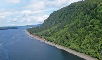
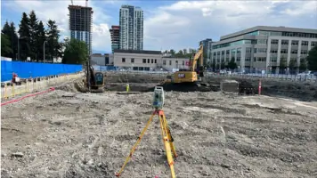
Our heavy civil surveying services provide precise data for roads, bridges, and railways using GPS and robotic total stations. This ensures accurate planning and execution of large-scale infrastructure projects. Our technology reduces field time while maintaining high accuracy, enabling efficient project completion.
Drone Aerial Mapping
Partnering with SWIFT, we use drones equipped with LiDAR and thermal imaging to create detailed 3D models and orthomosaic maps. This technology allows rapid data collection over large areas, improving safety and reducing surveying time by eliminating hazardous manual measurements.
Machine Control Optimization
Our machine control systems automate construction equipment like excavators and graders using GPS data. This technology enhances precision, reduces human error, and improves productivity by up to 46% while lowering fuel consumption and equipment wear during road and infrastructure projects.
Engineering Surveying
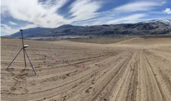
We offer engineering surveying for precise land measurement using RTK GPS and bathymetric mapping. Our services ensure structures are built to exact specifications, optimizing functionality and safety while minimizing design errors and costly rework during industrial and civil construction projects.
SmartSite Turn-Key Solution
SmartSite integrates geomatics, 3D modeling, and machine control to reduce rework by 20%+. This solution streamlines project workflows, improves productivity, and ensures accurate execution of complex construction plans through real-time data analysis and automated systems.
People
Jeff Ennis
Co-Owner/CEO
Jeff Ennis co-founded OSDC in 2001 after working with a leading North American surveying firm. He specializes in heavy civil projects and has expanded international airport infrastructure. Jeff holds a purple belt in jiu jitsu and enjoys outdoor activities with his family.
Kristen Livingston
Office Manager
Kristen Livingston brings over a decade of construction industry experience to OSDC's administrative operations. She excels in streamlining financial processes and office management while balancing her passion for travel and youth soccer coaching.
Eric Miller
Crew Supervisor
Eric Miller graduated from Okanagan College with a Civil Engineering Technology degree in 2005. He has been instrumental in OSDC's project execution since 2014, combining technical expertise with a commitment to family and outdoor recreation.
Adhit Nugraha
Survey Technician
Adhit holds degrees in Mining and Geomatics Engineering Technology from BCIT. He contributes technical expertise while racing motorcycles and mentoring young riders, balancing professional dedication with family time and motorsport passion.
Samantha King
Survey Technician
Samantha King began her career in Fort McMurray in 2009, specializing in underground surveying. A dedicated vegan and animal lover, she combines field expertise with a passion for travel and outdoor adventures with her weiner dog companion.
Questions
What services does OSDC offer?
OSDC provides geomatics and construction surveying services including heavy civil surveying, drone aerial mapping, machine control optimization, engineering surveying, and 3D modeling for infrastructure and industrial projects.
What industries does OSDC specialize in?
We specialize in heavy civil construction (roads, bridges, railways), industrial facilities (factories, power plants), and mining infrastructure projects requiring precise surveying and geomatics solutions.
How does OSDC ensure project safety?
OSDC maintains COR certification through the British Columbia Construction Safety Alliance, implementing rigorous safety protocols and training programs to ensure safe operations on all job sites.
What technologies does OSDC use?
We utilize GPS systems, robotic total stations, LiDAR, drones, and machine control technology to enhance accuracy, reduce rework, and improve project efficiency.
How does OSDC reduce construction costs?
Our SmartSite solution minimizes rework by 20%+ through real-time data analysis and machine control optimization, reducing project delays and unnecessary expenses.
Can OSDC handle large-scale infrastructure projects?
Yes, with over 30 years of experience and a proven track record in complex projects, we deliver scalable solutions for large infrastructure developments while maintaining precision and efficiency.