Business Details
44 Years
experience
Reliable Land Survey Services in Eastern Ontario
Established in 1982, Miller P A Surveying has built a reputation for delivering high-quality boundary, engineering, and mapping services across Eastern Ontario. Our team of certified professionals brings decades of collective experience in cadastral surveying, construction layout, and legal boundary resolution, supported by advanced technologies like GNSS and drone-based photogrammetry. We specialize in serving private property owners, government agencies, and major corporations, with a focus on precision, legal compliance, and client education.Our work spans diverse projectsfrom cottage boundary retracements to large-scale infrastructure monitoringwhile maintaining rigorous adherence to professional standards. Backed by memberships in top-tier surveying associations, we remain committed to advancing industry best practices and resolving complex geospatial challenges for our clients.
Services
Boundary Surveys
Severance Surveys
Drone Mapping
Engineering Surveys
Crown Lands Surveys
Details
- Year established: 1982
Highlights and features
- We offer 40+ years of expertise in cadastral and engineering surveying.
- Our team invests in advanced GNSS and drone technology for accuracy.
- We serve both private clients and major government agencies.
- Our professionals hold memberships in top surveying associations.
- We specialize in resolving complex boundary disputes with legal expertise.
Associations and certifications
- Association of Canada Lands Surveyors
- Association of Ontario Land Surveyors
- Canadian Federation of Independent Business
What people say
Quality of the work
Expertise in boundary disputes
Timely deliverables
Services
Boundary Surveys
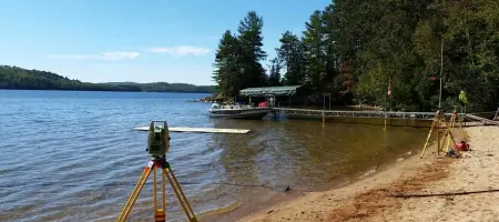
We conduct legal boundary retracements using historical records and modern GNSS technology to resolve property disputes. Our surveys ensure compliance with Ontario Land Surveyors standards and provide clear documentation for homeowners and legal professionals. Services include monument verification and shoreline allowance closures.
Drone Mapping
Our Unmanned Aerial Vehicle (UAV) technology captures high-resolution topographic data for construction progress, volumetric analysis, and subdivision plans. This method reduces field time while delivering precise 3D models and orthomosaic maps for engineering and municipal projects.
Severance Surveys
We administer Planning Act Consent Applications for property divisions, preparing legal descriptions and reference plans. Our team guides clients through municipal approval processes and coordinates with legal professionals to ensure compliant transactions for residential and commercial land sales.
Engineering Surveys
We provide precise control surveys for infrastructure projects, including roadways, utilities, and building foundations. Using high-precision total stations and GNSS systems, we ensure alignment with design specifications and regulatory requirements for clients like Ontario Power Generation and Hydro One Networks.
Crown Lands Surveys
Our firm specializes in mapping Crown Reserves and Two-Storey Boathouse parcels, supporting cottagers seeking to purchase shoreline areas. We combine historical research with field verification to establish legal boundaries and prepare documentation for government agencies and private applicants.
People
Paul Miller
Managing Partner
Graduate of the University of Toronto's Survey Science Program. Commissioned as an Ontario Land Surveyor in 1980. Past member of the AOLS Academic and Experience Requirement Committee. Expert in boundary disputes and business management.
Kevin Smith
Managing Partner
University of New Brunswick graduate in Geodesy and Geomatics. Commissioned as an OLS in 2012. Led complex cadastral and engineering projects. Served on the AOLS Academic Committee from 2015 to 2023.
Taylor DeRuiter
Ontario Land Surveyor
University of New Brunswick graduate in Geodesy and Geomatics. Commissioned as an OLS in 2024. Specializes in legal boundary calculations and cadastral projects. Pursuing P.Eng certification with Professional Engineers Ontario.
Aldis Karklins
Canada Lands Surveyor
50+ years of experience in boundary and engineering surveys across Canada and internationally. Former President of A. Karklins Surveying Ltd. and Manager of Ontario Hydro's Survey Division. Author of multiple professional publications.
Questions
Why does verifying a single survey monument cost so much?
Legal boundary verification requires title research, field analysis of monuments and physical evidence, and compliance with the Surveys Act to ensure legally defensible results.
What should I do if a neighbor removes a survey monument?
Contact an Ontario Land Surveyor to mediate and re-establish the boundary. If uncooperative, file a police report as monument removal violates the Criminal Code.
Can surveyors legally access my property without permission?
Yes. The Surveys Act grants statutory protection for surveyors to access properties to perform legal retracement work, though urban courtesies are typically observed.
How do I start a property severance process?
Contact a municipal office or surveyor to prepare a Consent to Sever application, engage an Ontario Land Surveyor for reference plans, and consult legal professionals for the sale.