
Business Details
36 Years
experience
Your Geomatics Partner for Western Canada
Caltech Surveys Land Surveying BC has established itself over 30 years as a leader in geomatics services across Western Canada. Our team combines decades of real-world experience with cutting-edge technology to deliver accurate, efficient, and safe solutions for surveying, geospatial analysis, and GIS services. We prioritize client success through regulatory guidance, technical expertise, and a commitment to safety, quality, and innovation.Our ISO 9001-certified quality management system ensures excellence, while our partnerships with clients across industries demonstrate our ability to adapt to complex project demands. With over 160 geomatics experts, we maintain small-company values while offering large-scale capacity.
Services
Surveying
Geospatial Analysis
GIS Services
Pipeline Integrity
Aerial Mapping
Mobile Mapping
Laser Scanning
Bathymetric Surveying
Details
- Year established: 1990
Highlights and features
- We offer 30+ years of geomatics expertise in Western Canada's challenging environments
- Our ISO 9001-certified quality management ensures consistent, accurate results
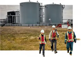
- We operate 6 safety compliance programs for project risk reduction
- We combine legacy experience with RPAS and 3D mapping technologies
- Our 160+ experts provide full-spectrum geomatics capabilities across multiple industries
Associations and certifications
- ISO 9001:2015
Services
Surveying
Our surveying services combine 30+ years of expertise with modern technology to deliver precise measurements for legal, construction, and regulatory purposes. Professional surveyors and engineers handle pipeline routes, boundary stakings, and topographic assessments while maintaining compliance with provincial regulations. Clients benefit from accurate data that forms the foundation for successful infrastructure, mining, and municipal projects.
Geospatial Analysis
We transform raw data into actionable insights through advanced geospatial analysis using tools like ArcGIS Pro and LiDAR. Our experts create detailed 3D models for infrastructure planning, environmental assessments, and resource management. Clients receive customized mapping solutions that integrate with WebGIS platforms, enabling real-time decision-making across oil & gas, power, and municipal sectors.
GIS Services
Our GIS specialists develop comprehensive mapping systems that track assets, manage regulatory compliance, and optimize project workflows. From pipeline integrity monitoring to municipal asset databases, we deliver customized GIS tools that support long-term infrastructure planning. Clients access secure data portals for real-time project information and reporting.
Pipeline Integrity
We ensure pipeline safety through specialized integrity assessments covering route optimization, depth monitoring, and corrosion protection. Our surveys support regulatory compliance while extending infrastructure lifespan. Clients receive detailed deformation analyses and inline inspection support for maintaining operational safety in energy transportation systems.
Aerial Mapping
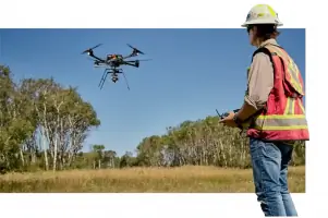
Using remotely piloted aircraft systems, we collect high-resolution aerial data for challenging terrains with greater safety and efficiency. Our drone mapping services generate accurate topographic models for construction planning, environmental assessments, and land development. Clients benefit from cost-effective data collection that minimizes field time and site disruption.
People
Jade McLeod
President
With over 30 years in geomatics, McLeod leads Caltech Surveys Land Surveying BC's strategic vision while maintaining technical oversight. Her expertise includes cadastral surveys and regulatory frameworks across Western Canada's energy sector.
Travis Wolfe
Vice President, Operations
Wolfe oversees operational excellence in surveying and geospatial services, ensuring ISO 9001 compliance while optimizing field-to-office workflows for complex infrastructure projects.
Rory Brown
Vice President, Business Development
Brown builds industry partnerships across oil & gas and mining sectors, leveraging technical knowledge to align Caltech Surveys Land Surveying BC's geomatics solutions with client project lifecycles.
Ryan Burke
Geospatial Project Manager
Burke specializes in integrating advanced technologies like LiDAR and mobile mapping systems for pipeline and infrastructure projects, ensuring technical accuracy meets client requirements.
Lee Cole
Director, QHSE
Cole manages safety compliance programs across six platforms, implementing Caltech Surveys Land Surveying BC's COR-certified safety protocols for field operations and data collection in high-risk environments.
Questions
What geomatics services does Caltech Surveys Land Surveying BC specialize in?
We provide surveying, geospatial analysis, GIS mapping, pipeline integrity assessments, and aerial/mobile mapping services tailored to Western Canada's energy and infrastructure sectors.
How does Caltech Surveys Land Surveying BC ensure project accuracy?
Our ISO 9001-certified quality management system combines legacy experience with modern technology like RPAS and 3D laser scanning for precise, repeatable results.
What safety standards does Caltech Surveys Land Surveying BC maintain?
We hold a Certificate of Recognition (COR) and participate in six safety compliance programs including ISNetworld and SafeContractor for comprehensive risk management.
Which industries does Caltech Surveys Land Surveying BC serve?
We support oil & gas, mining, municipal, infrastructure, and power sectors with geomatics solutions that address regulatory challenges and technical requirements.
How does Caltech Surveys Land Surveying BC use geospatial technology?
We deploy remotely piloted aircraft systems, LiDAR acquisition, and WebGIS platforms to deliver real-time data visualization and analysis for project decision-making.
What's included in pipeline integrity services?
Our services cover route optimization, deformation monitoring, corrosion assessments, and regulatory mapping to ensure safe, compliant pipeline operations.