Business Details
50+ Years
experience
Professional Land Surveying Services in Nova Scotia
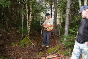
Established in 1975, Longstaff-Parker-Wamboldt Surveys has built a reputation as a leading land surveying firm in Nova Scotia. Our team of licensed professionals combines over 40 years of collective experience with advanced technology to deliver precise legal and construction surveying services. We specialize in boundary retracement, subdivision design, topographical mapping, and construction layout, serving homeowners, developers, and municipal clients across HRM and Nova Scotia. Our commitment to quality control, peer-reviewed processes, and strategic partnerships ensures every project meets exacting standards. With state-of-the-art equipment like robotic total stations and RTK GPS, we provide accurate data for infrastructure projects, residential developments, and commercial construction.Our expertise extends to geodetic control surveys, LiDAR analysis, and condominium development, supported by a network of engineering and legal professionals. We prioritize client collaboration, offering free consultations and tailored solutions to address unique surveying challenges. Our track record of completing projects on time and within budget reflects our dedication to efficiency and technical excellence. As active members of the Association of Nova Scotia Land Surveyors, we maintain the highest professional standards while continuously adapting to industry advancements.
Services
Legal Boundary Surveys
Subdivision Design
Topographical Surveys
Lot Grading Plans
Construction Layout
Pipeline As-Built Surveys
Condominium Surveys
Easement Surveys
Digital Terrain Modeling
LiDAR Consultations
Details
- Year established: 1975
Highlights and features
- We have over 40 years of combined experience in legal and construction surveying
- Our team uses state-of-the-art robotic total stations and RTK GPS technology
- We maintain partnerships with other surveying firms for large-scale projects
- All surveyors hold active licenses with Nova Scotia regulatory bodies
- We provide comprehensive 3D digital terrain modeling and LiDAR analysis
Associations and certifications
- Association of Nova Scotia Land Surveyors
- Canada Land Surveyor Commission
Services
Legal Boundary Surveys
Our legal boundary surveys redefine property lines using historical records and modern GPS technology. Licensed surveyors physically re-establish corner pins and produce certified plans registered in the Nova Scotia Land Registry. This service helps property owners resolve disputes before construction or land transactions.
Construction Surveys
We provide precise construction layout services for buildings, highways, and infrastructure projects. Using robotic total stations and RTK GPS, our team ensures accurate placement of foundations, utilities, and structural elements. This service helps developers meet municipal requirements and avoid costly rework during construction phases.
Topographical Surveys
Our topographical surveys document natural and man-made features on properties using advanced surveying equipment. The data creates detailed 3D models showing elevations, contours, and existing structures. This service supports engineering designs and development planning for residential, commercial, and industrial sites.
Lot Grading Plans
We develop lot grading plans required for new home construction in HRM and East Hants. Our package includes topographic surveys, foundation layout, and final grading certification. This service ensures compliance with municipal drainage regulations while protecting property owners' investments.
LiDAR Surveys
Our LiDAR survey consultations use aerial laser scanning to create high-resolution terrain models. This technology captures precise elevation data for large areas, supporting road design and subdivision planning. We provide cost-benefit analyses comparing LiDAR to traditional survey methods while maintaining required accuracy standards.
People
Tim Wamboldt
President & Nova Scotia Land Surveyor
With over 30 years in survey technology and engineering, Tim holds Nova Scotia Land Surveyor Licence #624. He founded Tim Wamboldt Surveys Ltd in 2008 before merging with Longstaff-Parker Surveys Inc. He graduated from the University of New Brunswick and College of Geographic Sciences.
Mike McKay
Office Technologist
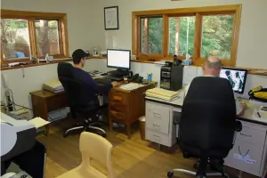
Mike brings 30 years of technical illustration and drafting experience to our team. Certified in AutoCAD, he graduated from the Technical University of Nova Scotia in 1993. His expertise ensures precise documentation and visualization of survey data for complex projects.
Garry Parker
Professional Engineer & Land Surveyor
With over 50 years in engineering and surveying, Garry holds dual licenses as a Nova Scotia Land Surveyor (#455) and Canada Land Surveyor. He earned his engineering degree from Dalhousie University in 1970 and has been a key contributor to major infrastructure projects across Nova Scotia.
Paul Handley
Field Technologist
Paul has over 45 years of field surveying experience and has been a Certified Engineering Technologist (C.E.T.) for 35 years. His expertise in field data collection and instrument operation supports our team's precision in boundary and construction surveys.
Frank Longstaff
Former Partner
Frank served as a Nova Scotia Land Surveyor from 1955 to 2015. His decades of experience contributed to the firm's foundational expertise in legal surveying. Though retired, his legacy continues through our established surveying methodologies and client relationships.
Questions
What surveying services do you offer?
We provide legal boundary surveys, construction layout, topographical mapping, lot grading plans, LiDAR surveys, and condominium development services. Our full list includes over 20 specialized surveying solutions for residential, commercial, and infrastructure projects.
Do you serve areas outside Halifax?
Yes, we serve all Nova Scotia regions including Annapolis Valley, South Shore, Pictou County, and Cape Breton. Our satellite office in Bear River supports projects in western Nova Scotia communities.
What information should I prepare before a survey?
Have your property deed, previous survey plans, and municipal correspondence ready. For construction projects, provide architectural drawings and development permits to help us complete surveys more efficiently.
How long does a typical survey take?
Most residential boundary surveys take 1-2 days for field work plus 5-7 business days for plan preparation. Larger projects like subdivisions or infrastructure surveys require customized timelines based on complexity.