Business Details
50+ Years
experience
Professional Land Surveyors in Salmon Arm
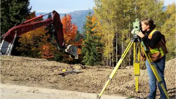
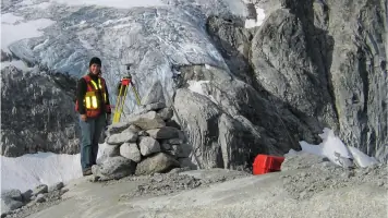
Established in 1961, we have dedicated six decades to delivering precise land surveying expertise across British Columbia's Columbia-Shuswap region. Our firm combines deep local knowledge with advanced surveying technology to address complex land development challenges for residential, commercial, and governmental clients. Our team of three commissioned British Columbia Land Surveyors and skilled technicians maintains rigorous technical standards while providing personalized service tailored to specific project requirements. We specialize in boundary surveys, building location certificates, and comprehensive land development planning, ensuring proper documentation of property rights and compliance with regulatory frameworks.Our safety-certified field crews operate modern Leica equipment and utilize digital workflows for efficient data collection and processing. With extensive archives dating back to our founding and secure digital backups, we preserve critical survey history while maintaining modern efficiency. Our commitment extends beyond technical excellence - we actively participate in professional associations and prioritize community relationships to better serve clients across Salmon Arm, Sicamous, Revelstoke, and surrounding areas. Through monthly safety meetings and comprehensive training programs, we ensure both personnel safety and technical accuracy on every job site.
Services
Boundary Surveys
Building Location Certificates
Site Surveys
Land Development Planning
Aboriginal Lands Surveys
Details
- Year established: 1961
Highlights and features
- 60+ years of combined experience in Columbia-Shuswap region
- Three certified British Columbia Land Surveyors on staff
- Modern Leica surveying equipment with digital workflows
- Comprehensive safety training and certified field crews
- Preserved survey records dating back to 1961
Associations and certifications
- British Columbia Land Surveyors
- Professional Surveyors Canada
- Land Title and Survey Authority
Services
Boundary Surveys
Our boundary surveys precisely establish property lines using official legal survey evidence. Our certified land surveyors retrace existing boundaries without creating new ones, ensuring proper monument placement and filing of official posting plans with the Land Title Office. This service helps property owners resolve boundary disputes, prepare for construction, or ensure compliance with setback requirements through accurate boundary documentation.
Building Location Certificates
We provide legally-valid building location certificates showing the exact position of structures relative to property boundaries. These documents, required for mortgage, real estate, and building inspection purposes, include digital signatures from practicing British Columbia Land Surveyors. Our rapid turnaround ensures smooth property transactions while maintaining strict accuracy standards for both new constructions and existing buildings.
Land Development Planning
From initial concept to final parcel creation, we guide clients through complete land development processes. Our services include subdivision planning, strata development, and construction layout surveys that show contractors precise building locations. Using advanced survey technology, we ensure proper positioning and compliance with zoning regulations for residential, commercial, and infrastructure development projects.
Site Surveys
Our detailed site surveys map existing features including topography, utilities, and access points to support development planning. Deliverables in PDF, paper, and CAD formats help architects and engineers design improvements that consider site-specific conditions. This service forms the foundation for riparian area regulation applications and engineering design projects requiring accurate terrain data.
Aboriginal Lands Surveys
We conduct specialized surveys for First Nation lands, treaty, and land claim projects with cultural sensitivity and technical precision. Our experience includes boundary definition for reserves, treaty lands, and traditional territories. We work collaboratively with Indigenous communities and government agencies to produce survey solutions that respect both modern standards and historical land relationships.
People
Nicole L. Bird
British Columbia Land Surveyor
Responsible for field operations management and office production since joining in 2014. Holds Geomatics Engineering diploma from BCIT and served as Okanagan Mainline Group Co-Chair.
Mark R. Mason
British Columbia Land Surveyor
Handles field assignments and development planning with 8+ years on BC Land Surveyors' Board of Management. Holds dual qualifications from University of Calgary and BCIT.
Joseph C. Johnson
Past Partner
Retired partner with 40 years' experience in legal surveying. Former BC Land Surveyors' Board Chair and life member of both BC and Canada Lands Surveyors associations.
Questions
What survey services do you offer?
We provide boundary surveys, building location certificates, site surveys, land development planning, and specialized surveys for Aboriginal lands, accident scenes, and deformation monitoring.
Which areas do you serve?
We serve Salmon Arm, Sicamous, Revelstoke, Armstrong, North Shuswap, and all municipalities within Columbia-Shuswap and adjacent regional districts.
How long have you been in business?
Established in 1961, we have over 60 years of continuous service providing land surveying expertise to clients throughout British Columbia.
What equipment do you use?
Our field crews utilize Leica robotic total stations, GNSS receivers, and digital levels. Office operations feature Microsurvey CAD and AutoCAD Civil 3D software for precision project execution.