Business Details
Trusted Geomatics Solutions in Vancouver
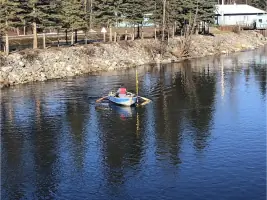
3D Geomatics is a trailblazing geomatics solutions provider with a legacy rooted in traditional surveying methodologies and modern technological innovation. Since our inception, we have delivered specialized engineering topographic surveys, construction layout, site plans, legal surveys, and volume surveys across western Canada. Our expertise is forged through decades of experience in challenging environments, including the rugged ecosystems of Vancouver Island. We combine advanced technologies such as 3D laser scanning, UAV/drone capabilities, and hydrographic surveys with a commitment to health, safety, and environmental excellence. Our team collaborates with public and private sector clients, including the BC Ministry of Transportation and Infrastructure, to provide tailored solutions that meet the unique demands of each project.With a COR-certified health and safety program, we prioritize accountability, innovation, and collaboration in every endeavor. Our core valuessynergy, integrity, passion, and ownershipguide our approach to delivering dependable, high-quality geomatics services. We pride ourselves on blending flexibility with decades of experience to ensure projects are completed efficiently and to the highest standards. Our team of seasoned professionals brings unparalleled expertise to civil surveying, legal boundary management, and advanced data processing. By fostering meaningful relationships with Indigenous communities and prioritizing inclusivity, we strive to leave a positive footprint in every project we undertake.
Services
Civil Surveying
Legal Surveying
3D Laser Scanning
CAD Processing
UAV/Drone Services
Highlights and features
- We offer over two decades of specialized geomatics expertise in challenging environments.
- Our team utilizes advanced 3D laser scanning and UAV/drone technologies for precise data capture.
- We maintain a COR-certified Health, Safety, and Environmental program.
- Our services cater to both public and private sectors, including major infrastructure projects.
- We prioritize collaboration with Indigenous communities and sustainable practices.
Associations and certifications
- COR
What people say
Technical expertise
Reliable service
Advanced technology
Experienced team
Safety focus
Services
Civil Surveying
3D Geomatics provides comprehensive civil surveying services, including topographic, utility, and hydrographic surveys. Our expertise ensures accurate data collection for infrastructure projects, roadways, and construction sites. With decades of experience, we deliver reliable solutions for urban, rural, and remote environments.
Legal Surveying
Our legal surveying division specializes in boundary management, subdivisions, and cadastral surveys. We adhere to provincial and federal standards for land development and registration. Our team ensures compliance with regulatory requirements for commercial, industrial, and residential projects across British Columbia.
3D Laser Scanning
We utilize advanced 3D laser scanning for precise data capture in infrastructure, architectural, and marine projects. This technology enables efficient documentation of complex structures and terrain. Our services support construction, engineering, and quality assurance applications with high-resolution point cloud data.
UAV/Drone Services
Our UAV/drone capabilities provide aerial imagery and LiDAR data for hard-to-reach sites. This technology enhances survey efficiency and accuracy for large-scale projects. We deliver detailed topographic maps and volumetric analysis for transportation, construction, and environmental monitoring.
CAD Processing
We create high-quality CAD and Civil 3D deliverables, including site plans, terrain models, and volume calculations. Our team ensures precision in data processing for construction layouts and machine control files. These services support engineering and infrastructure projects with reliable digital representations.
People
Kevin Laiss
President
With over 35 years of experience, Kevin Laiss leads 3D Geomatics as President. His expertise spans surveying, construction project management, and office operations. He specializes in topographic surveys, road construction, and underground line locating.
David Bleay
Vice President
David Bleay oversees corporate operations and the COR Safety Program at 3D Geomatics. With 25+ years in surveying, he specializes in site control surveys, legal boundary surveys, and machine control equipment. He also manages HR and financial strategies.
Barry Fisk
Founder
Barry Fisk, founder of 3D Geomatics, brings 45 years of surveying experience. He excels in project management and technical solutions, with deep knowledge of BC MOTI standards. His career includes roles at the BC Ministry of Transportation.
Aaron Shufletoski
President of 3D Land Surveying Inc.
Aaron Shufletoski leads 3D Land Surveying Inc. with 30 years of legal surveying experience. He specializes in boundary determination, subdivisions, and strata surveys. He actively contributes to BC's land surveying regulatory community.
Andrew Torgerson
3D Laser Scanning Specialist
Andrew Torgerson specializes in 3D scanning and LiDAR processing with 18 years in the industry. He previously owned Surface & Edge 3D Inc., which merged with 3D Geomatics in 2020. He also operates as a UAV pilot.
Questions
What services does 3D Geomatics offer?
We provide civil surveying, legal boundary surveys, 3D laser scanning, UAV/drone services, and CAD data processing for infrastructure and development projects.
Which areas do you serve?
We operate throughout British Columbia and western Canada, supporting both public and private sector clients in diverse environments.
What technologies do you use?
We employ 3D laser scanning, UAV/drone imagery, LiDAR, and advanced CAD software to deliver precise geomatics solutions.
Are you certified in safety standards?
Yes, we maintain a COR-certified Health, Safety, and Environmental program to ensure project safety and compliance.
How experienced is your team?
Our team has decades of combined experience in surveying, with expertise in challenging environments and complex infrastructure projects.