
Business Details
18 Years
experience
Professional Land Surveyors in Medicine Hat
Established in 2008, Benchmark Geomatics combines traditional customer service values with cutting-edge technology to deliver precise surveying solutions. Our team brings over 30 years of combined experience in Alberta, specializing in both legal and construction surveying. We focus on accurate boundary determination, municipal compliance, and innovative UAV (drone) mapping to serve real estate, infrastructure, and industrial clients. Our local ownership ensures personalized attention to Medicine Hat and surrounding communities, providing quality results at competitive prices. We maintain memberships with the Alberta Land Surveyors Association, Medicine Hat Chamber of Commerce, and Better Business Bureau to uphold industry standards.Our expertise spans land subdivisions, dam construction, solar farm layouts, and complex legal documentation such as Real Property Reports. We distinguish ourselves through technical excellence, rapid project turnaround, and adherence to regulatory requirements across southern Alberta. Our multidisciplinary team holds certifications in geomatics engineering and civil design, ensuring compliance with all provincial land use regulations. We invest in ongoing training for our certified RPAS pilots to maintain leadership in drone survey technology. Clients trust our meticulous approach to boundary disputes, encroachment verification, and 3D modeling for both small-scale renovations and large infrastructure developments.

Services
Legal Land Surveying
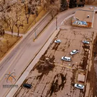
UAV Drone Surveys
Real Property Reports
Construction Surveys
Municipal Compliance
Land Subdivisions
Dam Construction Surveys
Commercial Development Surveys
Topographic Mapping
Powerline Surveys
Details
- Year established: 2008
Highlights and features
- We are 100% locally owned and operated in Medicine Hat, providing community-focused service.
- Our team holds certifications from the Alberta Land Surveyors Association and RPAS licensing.
- We combine 30+ years of Alberta survey experience with drone technology for faster results.
- We offer end-to-end municipal compliance assistance to streamline client processes.
- Our geomatics engineers deliver precise boundary solutions for complex real estate transactions.
Services
Legal Land Surveying
We conduct precise boundary determinations using legal records and geospatial technology to establish property lines, easements, and encroachments. Our surveys support real estate transactions, subdivision plans, and dispute resolution. Clients receive official documentation compliant with Alberta Land Surveyors Association standards.
UAV Drone Surveys
Our RPAS-certified pilots capture high-resolution aerial data for topographic maps, progress reports, and 3D modeling. This technology reduces survey time by 70% while maintaining sub-centimeter accuracy for infrastructure, agriculture, and environmental monitoring projects.
Real Property Reports
We prepare legally defensible RPRs showing building locations, setbacks, and municipal compliance status. These reports facilitate property sales, mortgage approvals, and zoning verification with clear graphical and written evidence of land use conformity.
Municipal Compliance
Our team ensures survey plans meet local bylaws through official compliance stamps and submittals. We coordinate directly with municipalities to resolve zoning conflicts, bylaw violations, and land use amendments as part of integrated project delivery.
Construction Surveys
We provide precise staking, grading, and as-built verification for roads, utilities, and buildings. Services include pile positioning, asphalt staking, and utility mapping to maintain construction accuracy within 5mm tolerances across commercial and industrial developments.
People
Adam Thompson
Project Manager - Legal Surveys
Alberta Land Surveyor with 20+ years of experience in property boundary determination and legal reporting. Holds a Geomatics Engineering degree from the University of New Brunswick and actively contributes to the Alberta Land Surveyors Association.
Kirby Finley
Senior Engineer - Civil Design
Professional Engineer specializing in sustainable infrastructure solutions. With expertise in municipal projects, Kirby delivers efficient engineering designs while maintaining safety compliance and environmental stewardship in Medicine Hat developments.
Graeme Teare
Project Manager - Construction Surveys
Geomatics Engineering Technologist with a decade of large-scale project management experience. Specializes in subdivision development, dam construction, and industrial plant as-builts for complex Alberta infrastructure projects.
Questions
What is a Real Property Report (RPR)?
A Real Property Report is a legal document showing property boundaries, improvements, easements, and encroachments. It's used in real estate transactions to verify compliance with municipal bylaws and protect buyer/seller interests.
What areas do you serve?
We operate primarily in Medicine Hat and surrounding communities across southern Alberta, supporting both urban development and rural infrastructure projects.
Do you offer drone/UAV surveying services?
Yes, our RPAS-certified pilots provide drone mapping for rapid data collection, creating 3D models and ortho-images for construction progress, volume calculations, and environmental monitoring.
How do you handle municipal compliance?
We prepare required documentation and submit compliance applications to local governments, ensuring projects meet zoning regulations and land use bylaws without client effort.
What construction survey services are available?
We provide building layouts, road/bridge staking, pile positioning, utility mapping, and as-built documentation for flood restoration, subdivisions, and industrial developments.